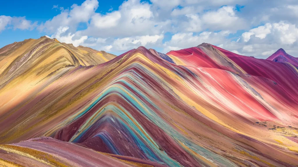

Choosing between palcoyo vs vinicunca is one of the most critical decisions you will make when planning an alpine day trek from Cusco. Both destinations showcase Peru’s striking mineral-striped geological formations, yet the physical reality on the ground could not be more contrasting. Booking the wrong route can mean enduring a grueling, oxygen-deprived scramble alongside thousands of hurried tourists, or missing out on the iconic high-pass view you envisioned.
Most travelers default to Vinicunca simply because of viral social media posts, unaware that it requires a steep ascent surpassing 5,200 meters (17,060 feet). Budget tour operators pack thirty passengers into shared buses departing at 3:00 AM, leaving hikers gasping for breath on crowded switchbacks without medical oversight or pulse oximeter monitoring.
You deserve an expedition tailored to your physical condition, photography goals, and personal travel style. Whether you choose the challenging summit push of Vinicunca or the serene, gradual trails of Palccoyo (also spelled Palcoyo), understanding the nuances of terrain, altitude, and crowd density ensures your Andean journey is safe, enriching, and unforgettable.
1. Side-by-Side Comparison: Palcoyo vs Vinicunca at a Glance
When evaluating vinicunca vs palccoyo, key differences in hiking duration, elevation gain, and visitor volume determine which experience suits your physical preparation.
Core Route Metrics and Trail Specifications
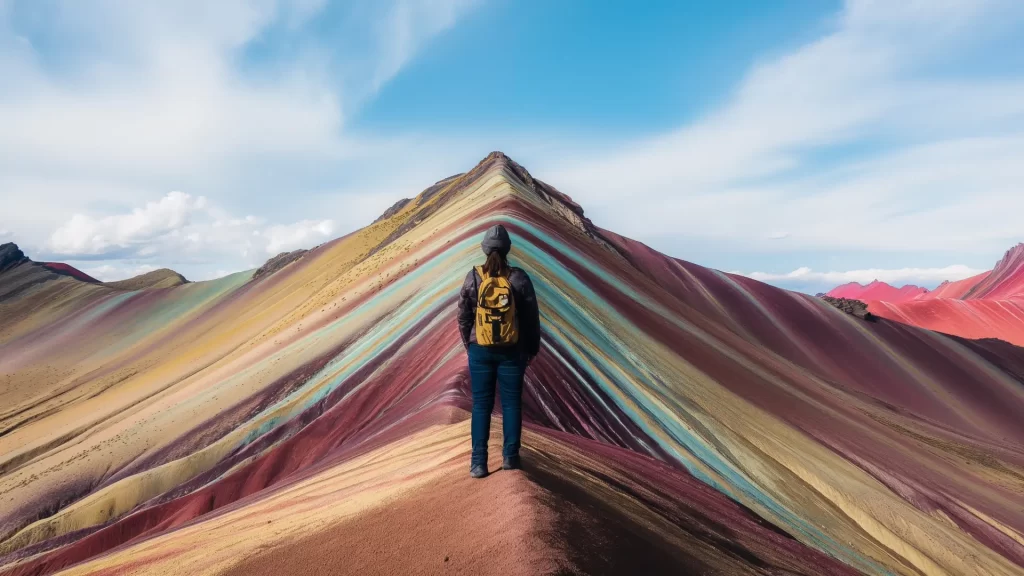
Vinicunca represents the classic high-intensity trek. You start hiking from the Llanto (Cusipata) parking area at 4,600 meters (15,090 feet) and climb roughly 600 vertical meters over 4.5 kilometers (2.8 miles) to reach the main viewpoint at 5,200 meters (17,060 feet). The final 500 meters feature steep, rocky switchbacks where atmospheric pressure drops significantly.
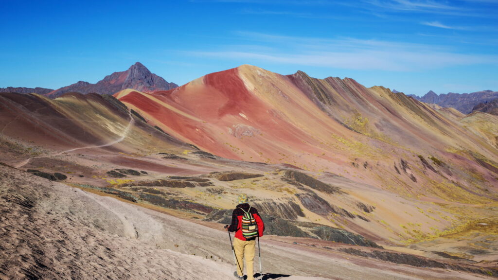
By contrast, the rainbow mountain alternative of Palcoyo provides a gentle, gradual approach. Your private transport winds up to an upper plateau parking area at 4,900 meters (16,076 feet). From there, the walk involves a gentle 1.5-kilometer (0.9-mile) path with a modest elevation gain of only 100 meters, taking around 45 minutes of easy strolling to reach sweeping ridge overlooks.
| Trail Metric | Vinicunca (Classic Ridge) | Palcoyo / Palccoyo (Alternative) |
|---|---|---|
| Viewpoint Elevation | 5,200 m / 17,060 ft | 4,900–5,000 m / 16,076–16,400 ft |
| Trailhead Starting Height | 4,600 m / 15,090 ft | 4,900 m / 16,076 ft |
| Vertical Elevation Gain | ~600 meters (1,970 ft) | ~100 meters (328 ft) |
| One-Way Hike Distance | 4.5 km / 2.8 miles | 1.5 km / 0.9 miles |
| Average Hiking Time | 3.5 to 4 hours round-trip | 1.5 to 2 hours round-trip |
| Physical Demand | Challenging (steep finish) | Gentle to moderate (scenic walk) |
| Daily Visitor Volume | 1,500 to 3,000+ hikers daily | 50 to 150 hikers daily |
| Primary Scenery | Single dramatic striped ridge & Ausangate | 3 colored valleys, stone forest & glacier |
Scenery: Single Striped Ridge vs. Valley Panorama
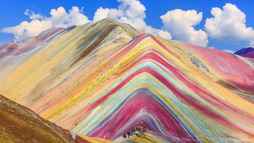
Vinicunca delivers the iconic triangular ridge featured across travel magazines. It overlooks a dramatic mountain col facing the glaciated south face of sacred Mount Ausangate. Hikers can also take a secondary spur into the vibrant red clay bluffs detailed in our guide to the Red Valley Cusco.
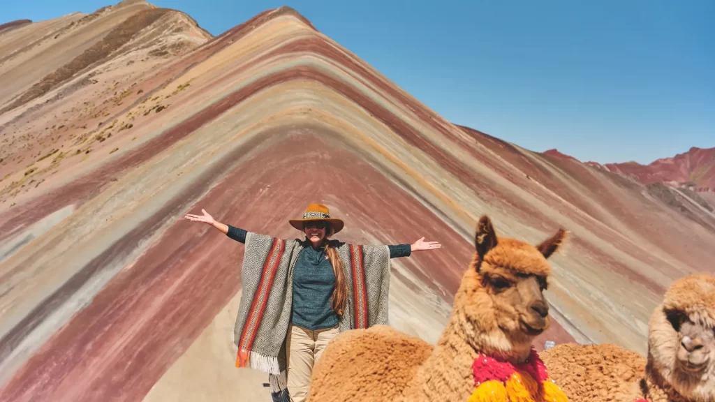
Palcoyo reveals an expansive geological basin. Instead of one single ridge, you view three distinct mineral-striped ridges simultaneously across the valley. The trail also winds directly through the Bosque de Piedras (Stone Forest), a dramatic labyrinth of towering weathered rock formations jutting from the high plateau.
“In comparing palccoyo vs vinicunca, fitness is not the only metric. Vinicunca feels like an athletic pilgrimage toward a famous summit pass. Palcoyo feels like walking through an open-air geological sanctuary in peaceful silence.”
— Senior Lead Expedition Guide, Qosqo Expeditions
2. Physical Demands and Altitude Acclimatization
Understanding high-altitude physiology is essential before confirming your mountain reservation. Both trailheads start well above the 4,500-meter mark.
Hiking Difficulty and Cardiovascular Stress
At 5,200 meters, each breath takes in approximately half the barometric oxygen density of sea level. On Vinicunca, the steep uphill switchbacks demand sustained cardiovascular work for over 90 minutes. For a deep breakdown of barometric numbers and acclimation timetables, review our complete Rainbow Mountain Guide & Tips.
Palcoyo bypasses the heavy vertical grind because the road carries your vehicle straight onto the highland plateau. The walking path follows a wide ridge line with minor undulations. This makes it far more accessible for multi-generational families, photography enthusiasts carrying heavy equipment, or travelers experiencing mild acclimatization headaches.
Horse Rentals and Trail Assistance
- Vinicunca Horse Support: Indigenous community members offer saddle horses for S/ 80 to S/ 100 Soles (~$22–$28 USD). Horses cover the first 3.8 kilometers of open valley, but cannot ascend the final steep switchbacks due to loose rock.
- Palcoyo Walking Ease: Saddle horses are rarely required or rented at Palcoyo because the trail is brief and mostly flat. The short distance allows you to move at a slow, restful cadence without strain.
3. Driving Logistics, Departure Times, and Crowds
Road transit and daily visitor distribution fundamentally alter your comfort and photography opportunities during both excursions.
Transit Routes from Cusco
Both trailheads lie southeast of Cusco along Highway 3S, passing through the historic Southern Valley towns of Urcos and Combapata:
- The Route to Vinicunca: Follows the highway to Cusipata, then branches onto a paved-and-gravel mountain road leading up to the Llanto checkpoint. The drive takes approximately 3 to 3.5 hours each direction.
- The Route to Palcoyo: Continues farther south along Highway 3S past Combapata, crossing an ancient colonial bridge before ascending a winding, unpaved rural road toward the upper pastures. Driving time averages 3.5 to 4 hours each way.
Crowd Flow and Atmosphere
When assessing palccoyo vs rainbow mountain, visitor volume is often the deciding factor. Vinicunca attracts dozens of large tour buses every morning. By 10:00 AM, the narrow ridge can hold upwards of a thousand visitors, turning scenic photography into an exercise in patience.
Palcoyo remains quiet throughout the morning. You can stand at the edge of the stone forest and look across striped canyons with only your private party and a few local alpaca herders in view. To understand the mineralogy behind these formations, explore our article on why Rainbow Mountain Peru is colorful.
4. Pallay Punchu vs Rainbow Mountain: The Third Alternative
Travelers seeking adventurous routes beyond Vinicunca and Palcoyo often discover Pallay Punchu (also called Pallay Poncho), Cusco’s newest colorful geological attraction.
Terrain and Geological Character of Pallay Punchu
In a direct comparison of pallay punchu vs rainbow mountain, Pallay Punchu stands out for its razor-sharp topography. Located in the Canas province near the high-altitude Lake Langui, its mineral ridges form jagged, needle-like crests resembling the pointed pattern of a traditional Andean poncho (punchu).
The ridge sits at 4,790 meters (15,715 feet). The ascent requires hiking along steep, exposed knife-edge paths that demand surefooted hiking and comfort with sheer drops on either side.
Travel Time and Infrastructure Comparison
- Driving Distance: Pallay Punchu sits roughly 190 kilometers (118 miles) southeast of Cusco, requiring a 4 to 4.5 hour drive each way.
- Trail Infrastructure: Very rustic. Trails lack built steps, railing safeguards, or formal rest checkpoints.
- Best Suited For: Hardy trekkers who prioritize complete wilderness isolation and dramatic ridge knife-edges over established trail comfort.
For discerning travelers who prefer peaceful exploration with comfortable trails, our Palcoyo Rainbow Mountain Tour provides the ideal balance of luxury transport, certified wilderness guides, and unspoiled scenery.
5. Frequently Asked Questions (FAQ)
What is the difference between Vinicunca and Palcoyo?
Vinicunca features a single famous striped ridge requiring a demanding 4-hour round-trip trek to 5,200 meters. Palcoyo displays three colorful valleys and a stone forest via a gentle 45-minute scenic ridge walk.
- Trail Elevation: Vinicunca reaches 5,200 m (17,060 ft); Palcoyo peaks near 4,900 m (16,076 ft).
- Hiking Effort: Vinicunca demands 600 m of steep climbing; Palcoyo requires only 100 m of gradual ascent.
- Crowd Atmosphere: Vinicunca hosts thousands daily; Palcoyo remains secluded and quiet.
Select Palcoyo if you want a relaxed, intimate experience without steep alpine switchbacks.
Which mountain is closer to Cusco?
Vinicunca is slightly closer by road distance, requiring about 3 to 3.5 hours of driving. Palcoyo requires 3.5 to 4 hours because the vehicle travels further south toward Combapata before climbing dirt mountain roads.
- Vinicunca Drive Time: 3 to 3.5 hours each direction (approx. 100 km).
- Palcoyo Drive Time: 3.5 to 4 hours each direction (approx. 125 km).
- Road Conditions: Both routes combine paved highway travel with winding rural dirt ascents.
Private luxury transport makes Palcoyo’s slightly longer drive comfortable with heated executive seating.
Which one is easier if I am not acclimatized?
Palcoyo is significantly easier and safer for travelers with limited acclimatization time. The trail is short and mostly flat, reducing cardiovascular strain while keeping you within easy reach of vehicle oxygen.
- Cardiovascular Load: Palcoyo involves a gentle walk rather than intense uphill exertion.
- Trail Distance: A brief 1.5-kilometer path compared to Vinicunca’s 4.5-kilometer climb.
- Safety Margin: You remain within 30 to 40 minutes of your vehicle at all times.
Spend at least 48 hours acclimatizing in Cusco before attempting either high-altitude destination.
Can I visit both Vinicunca and Palcoyo on the same trip?
Yes, but attempting both on a single day is not feasible due to remote valley locations and high physical fatigue. You can easily schedule them on separate days within a broader Cusco itinerary.
- Separate Valleys: The trailheads lie in different mountain corridors with no direct connecting road.
- Physical Recovery: High-altitude fatigue requires a day of rest or Sacred Valley touring between hikes.
- Suggested Itinerary: Hike Palcoyo early in your trip, followed by Vinicunca once fully acclimated.
Schedule an easy valley tour between high-altitude treks to maintain peak physical energy.
How does Pallay Punchu compare to Vinicunca and Palcoyo?
Pallay Punchu features razor-sharp pointed crests and deep isolation above Lake Langui. However, it requires a 4.5-hour drive and steep walking along exposed cliff paths without established safety rails.
- Topography: Jagged sawtooth ridges resembling poncho textiles rather than rounded hills.
- Drive Distance: Furthest from Cusco (approx. 190 km / 4.5 hours each direction).
- Trail Setting: Completely rustic with minimal trail markers and virtually no crowds.
Choose Pallay Punchu only if you are confident with steep ridgeline exposure and long transit days.
Which mountain offers better photography opportunities?
Palcoyo provides superior wide-angle photography because you can capture three striped ridges, grazing alpaca herds, and the stone forest without dozens of tourists blocking your frame.
- Crowd Obstruction: Minimal at Palcoyo, allowing clean landscape panoramas.
- Iconic Single Shot: Vinicunca delivers the world-famous triangular colored mountain face.
- Lighting Angles: Both offer optimal contrast between 8:30 AM and 10:30 AM under morning sun.
Equip your camera with a circular polarizer to balance mineral reflections at high altitude.
Are horse rentals available at Palcoyo?
Horses are rarely needed or stationed at Palcoyo because the hiking path is gentle and brief. Local handlers occasionally offer rides, but the majority of visitors complete the walk on foot.
- Trail Accessibility: The 1.5-kilometer trail requires minimal elevation gain.
- Horse Availability: Sporadic compared to the organized horse queues at Vinicunca.
- Rest Benches: Natural stone resting points are spaced comfortably along the trail.
Take unhurried, measured steps to comfortably manage the gentle ridge walk without animal assistance.
Is Palcoyo suitable for children and seniors?
Yes, Palcoyo is the preferred choice for multi-generational families. The wide, gradual path allows children and active seniors to enjoy Peru’s colorful mountains without enduring Vinicunca’s punishing climb.
- Gradual Slope: Avoids steep scrambles and slippery scree switchbacks.
- Flexible Turnaround: Scenic views open up within the first ten minutes of walking.
- Vehicle Proximity: Emergency descent to warm vehicle transport is swift and simple.
Carry warm thermal beanies and insulated gloves for family members of all ages.
What are the entrance fees for Palcoyo and Vinicunca?
Both trailheads collect cash admission fees managed by local Quechua community councils. Fees support regional roadway upkeep, trail safety measures, and local village schools.
- Vinicunca Community Fee: S/ 25.00 Soles (~$7.00 USD) for foreign travelers.
- Palcoyo Community Fee: S/ 20.00 Soles (~$5.50 USD) per international visitor.
- Payment Form: Exact cash in Peruvian Soles only; electronic payments are unavailable.
Keep crisp, small banknotes handy in your daypack for community checkpoint stops.
What weather conditions can I expect at Palcoyo?
Palcoyo experiences classic high-Andean alpine weather. Crisp, sub-freezing mornings transition into sunny mid-mornings, with sudden cold winds and rapid temperature swings common throughout the day.
- Morning Temperatures: Often drop between -3°C and 2°C (26°F to 35°F) before sunrise.
- Midday Radiation: Intense UV exposure requires SPF 50+ sunscreen and polarized eyewear.
- Seasonal Shifts: May to September offers clear blue skies; November to March brings afternoon showers.
Dress in versatile technical layers to easily adjust as alpine temperatures rise during the walk.