
Understanding the exact elevation of Rainbow Mountain is the first step toward a safe, successful trek. Standing over 5,000 meters above sea level sounds exhilarating until sudden shortness of breath, a pounding headache, and heavy legs set in. For travelers in the southern Peruvian Andes, acute mountain sickness is not just an inconvenience; it can bring your dream trip to a sudden halt.
Most visitors book standard budget group excursions with thirty or more passengers per bus, departing Cusco at 3:00 AM only to be rushed up a steep ridge without certified medical oversight. When blood oxygen drops, those hurried tours leave you stranded along the trail, fighting intense nausea and exhaustion while crowds pack the viewing platforms.
You deserve a safer, better-planned alpine experience. By respecting the true elevation of Rainbow Mountain, following a measured acclimatization schedule, and choosing private transport equipped with medical-grade oxygen and certified Wilderness First Responder (WFR) guides, you turn an intimidating high-altitude trek into an extraordinary achievement.
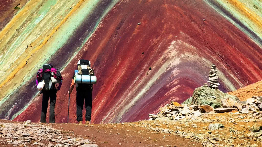
High-Altitude Physiology: The Real Elevation of Rainbow Mountain
Conquering the summit ridge of Vinicunca requires an honest look at atmospheric physics and the way extreme height affects your cardiovascular system.
Summit Metrics: What Is the Elevation of Rainbow Mountain?
The main observation viewpoint sits at an impressive elevation of Rainbow Mountain reaching 5,200 meters (17,060 feet) above sea level. This high Andean pass stands well above Mont Blanc in Europe (4,809 m) and outclimbs Mount Whitney in the United States (4,421 m).
Hikers start the walk from the trailhead parking zone at 4,600 meters (15,090 feet). That means you climb roughly 600 vertical meters (1,970 feet) in an alpine zone with substantially reduced atmospheric pressure.
Barometric Pressure and Oxygen Saturation at Summit Heights
The proportion of oxygen in atmospheric air stays near 21% everywhere; the real factor is barometric pressure. At sea level, air pressure averages 760 mmHg, driving oxygen efficiently through lung walls and straight into your bloodstream.
At the final elevation of Rainbow Mountain, barometric pressure drops to approximately 405 mmHg—nearly half of sea-level density. Each breath delivers far fewer usable oxygen molecules, requiring your heart and lungs to work twice as hard to power your stride.
High-Altitude Hypoxia Matrix
• Cusco City (3,400 m / 11,152 ft): Baseline effective atmospheric intake sits around 68%. Elevated resting heart rate is common during initial days.
• Trailhead Parking (4,600 m / 15,091 ft): Arterial oxygen saturation (SpO2) routinely drops from normal sea-level levels (98%) down to 80–86%.
• Summit Ridge (5,200 m / 17,060 ft): The peak elevation delivers approximately 52% effective oxygen volume. Muscle endurance drops by up to 40%, making slow, rhythmic steps mandatory.
Acclimatization Strategy for Extreme Heights
Attempting this hike within 24 to 48 hours of landing in Cusco is the most frequent reason travelers fail to finish. Cusco sits at 3,400 meters, an altitude that already demands serious physiological adaptation from your circulatory system.
Your kidneys need at least two full days to adjust bicarbonate retention and stabilize blood pH, prompting bone marrow to produce extra red blood cells. Spend your initial 48 to 72 hours exploring gentler valley floors—such as Pisac or Ollantaytambo—before challenging this high summit.
Geography and Geology: Where Is Rainbow Mountain and Why Is It Striped?
Understanding where Vinicunca is located and how its colored mineral stripes took shape brings deeper meaning to your entire hike.
Regional Setting and Travel Distances
Locally known as Vinicunca or Montaña de Siete Colores, the ridge sits along the high Andean plateau in the Quispicanchi and Canchis provinces of southern Peru, bordering the glaciated Ausangate range.
The mountain is situated roughly 100 kilometers (62 miles) southeast of Cusco’s historic center. Travel time averages 3 to 3.5 hours each direction by private transport, following the paved Southern Valley corridor before climbing mountain roads toward Cusipata or Pitumarca.
The Mineralogy Behind the Colors
The bright colored bands of Vinicunca developed through millions of years of marine sediment deposits, continental drift, and intense weathering:
- Red, Pink, and Fuchsia: Red marine clays enriched with iron oxides (hematite) formed during the Upper Tertiary period.
- White and Pale Gray: Quartz sandstone layers rich in calcium carbonate sediments.
- Green and Cyan: Phyllite claystone layers combined with copper and magnesium silicates.
- Yellow and Ochre: Limonite claystone layers packed with iron sulfide compounds.
- Deep Brown and Dark Red: Fanglomerate rock composed of gravel containing magnetite.
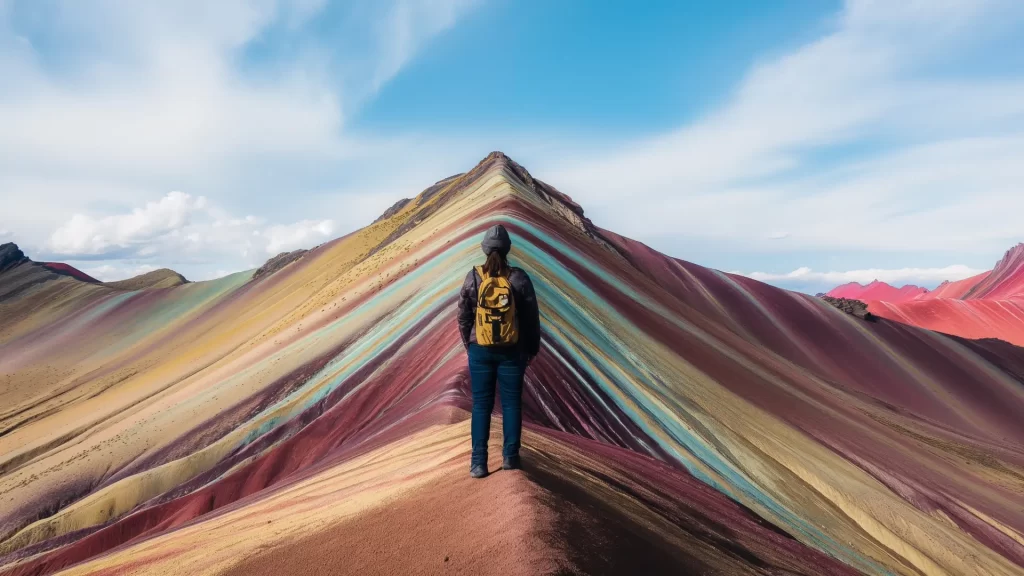
The Hike Experience: Routes, Trail Conditions, and Pace
Completing the trail safely requires steady pacing, sturdy hiking footwear, and an awareness of the physical demands of high-altitude ground.
Cusipata vs. Pitumarca Gateways
Travelers access the mountain through two distinct valley trailheads:
- The Cusipata (Llanto) Route: The primary and most accessible approach. A modern road leads to a large parking zone with local checkpoints, followed by a wide, gradual valley trail.
- The Pitumarca (Kayrawiri) Route: The traditional historical trail. It skirts closer to Mount Ausangate, featuring steeper paths that require careful footing when wet.
Distance and Trail Breakdown
From the Llanto parking area, the route covers roughly 4.5 kilometers (2.8 miles) to the pass, making for a 9-kilometer (5.6-mile) round-trip hike.
The first 4 kilometers follow an open, gentle slope across pastures filled with grazing alpacas. The final 500 meters switch into steep dirt turns, where the extreme elevation of Rainbow Mountain demands your slowest, most controlled pace.
“Vinicunca requires zero technical rock climbing. The true challenge is oxygen management. Keep an easy, conversational pace, link your breathing to each step, and never rush the open valley stretch.”
— Senior Lead Expedition Guide, Qosqo Expeditions
Community Horse Rentals
Native community associations at both trailheads offer saddle horses for hikers who need support along the valley floor:
- Horses can carry you across the first 3.5 to 4 kilometers of open trail.
- Handlers cannot take horses up the final 200-meter rocky summit pass due to steep, loose ground.
- Rentals cost between S/ 80 and S/ 100 Soles (~$22–$28 USD) one-way, paid in cash directly to the local handler.
If you prefer an equally striking alpine trek with flatter trails and fewer visitors, look into our Palcoyo Rainbow Mountain Tour.
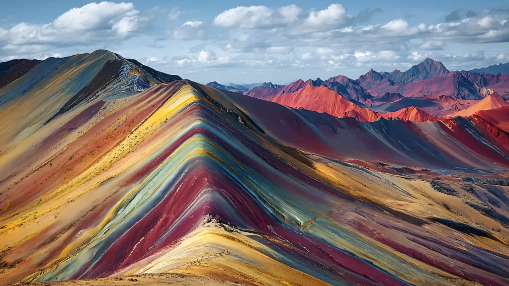
Planning Your Trip: Seasons, Costs, and Travel Standards
Smart timing, reliable gear, and clear logistics make all the difference on an alpine journey of this scale.
Best Time to Visit Rainbow Mountain
Weather conditions across the southern Andes shift dramatically between seasons:
- Dry Season (May to September): Clear, sunlit skies provide pristine views of the colored strata and nearby snowfields. Early morning temperatures at the starting lot often drop below freezing (-3°C to 2°C).
- Shoulder Season (April and October): Reliable conditions with lighter trail crowds and brief scattered showers.
- Rainy Season (November to March): Frequent rain, dense cloud cover, and occasional snowstorms. Heavy snow can temporarily blanket the colorful slopes.
Essential Packing Checklist
- Layering System: Breathable thermal base layer, insulating fleece mid-layer, and a windproof, waterproof outer shell.
- Footwear: Broken-in trekking boots with sturdy ankle support and deep rubber lugs.
- Sun Protection: UV400 polarized sunglasses, SPF 50+ mineral sunscreen, protective lip balm, and a sun hat.
- Cold-Weather Gear: Warm wool beanie, insulated gloves, and trekking poles with rubber caps.
- Cash: Small notes in Peruvian Soles for entry checkpoints, restrooms, and local trail snacks.
Ticket Prices and Checkpoints
Trail access is maintained directly by native community councils (primarily Chillihuani and neighboring villages):
- Foreign Visitors: S/ 25.00 Soles (approx. $7.00 USD).
- Peruvian Nationals: S/ 15.00 Soles (approx. $4.00 USD).
- Payment Note: Entrance fees are collected strictly in physical cash at community booths. Cards and electronic payments are not available.
Service Comparison: Standard Group Tours vs. Qosqo Expeditions VIP
| Feature | Standard Budget Group Tour | Qosqo Expeditions Private Service |
|---|---|---|
| Departure Schedule | 03:00 AM – 03:30 AM (lengthy hostel circuit) | Tailored Timing (scheduled to avoid peak trail crowds) |
| Group Size | 20 to 30 passengers per bus | 100% Private (dedicated strictly to your group) |
| Emergency Oxygen | Often absent or tiny aerosol cans | Full Medical Oxygen Tanks & Pulse Oximeters |
| Guide Certification | Standard tour guides without trauma training | Certified Wilderness First Responder (WFR) Guides |
| Vehicle Standards | High-mileage shared vans | High-End Climate-Controlled Executive Transport |
| Summit Timing | Reaches the pass during peak midday rushes | Private Cadence for quiet viewpoints and photography |
To safely navigate the high elevation of Rainbow Mountain with comprehensive medical support, explore our Private Rainbow Mountain Tour or discover our custom Machu Picchu & Andean Itineraries.
Frequently Asked Questions (FAQ)
What is the elevation of Rainbow Mountain in meters and feet?
The main summit viewpoint reaches an impressive elevation of Rainbow Mountain at 5,200 meters (17,060 feet) above sea level. Hikers begin the ascent from the Cusipata parking lot located at 4,600 meters (15,090 feet).
- Viewpoint Altitude: 5,200 m / 17,060 ft.
- Trailhead Elevation: 4,600 m / 15,090 ft.
- Vertical Climb: Roughly 600 vertical meters (1,970 ft).
Pause every twenty minutes along the steep switchbacks to keep your heart rate steady.
How far is Rainbow Mountain from Cusco and how long is the drive?
Vinicunca sits about 100 kilometers (62 miles) southeast of Cusco. The road journey takes between 3 and 3.5 hours each direction depending on mountain traffic and highway conditions.
- Driving Distance: 100 km (62 miles) each way.
- Transit Time: 3 to 3.5 hours per stretch.
- Highway Route: Southern Highway 3S through Cusipata or Pitumarca.
Traveling with a private driver lets you pass slow tour buses on the narrow unpaved tracks.
Do you need an entrance ticket for Rainbow Mountain?
Yes, every visitor must pay an entrance fee at community-managed checkpoints before stepping onto the path. These funds support rural infrastructure, trail maintenance, and local valley schools.
- Foreign Travelers: S/ 25.00 Soles (approx. $7.00 USD).
- Peruvian Citizens: S/ 15.00 Soles (approx. $4.00 USD).
- Accepted Payment: Exact cash in Peruvian Soles only.
Keep small banknotes handy in your daypack, as local community gates cannot change large bills.
Is the hike to Rainbow Mountain worth it?
Yes, standing before the mineral-striped slopes facing Mount Ausangate is one of South America’s most rewarding natural sights. The visual reward is outstanding when planned properly to bypass dense midday crowds.
- Geological Wonders: Naturally layered mineral deposits displayed across open ridges.
- Glacial Backdrops: Sweeping views of the 6,000-meter Ausangate snow range.
- High-Altitude Setting: A memorable physical accomplishment above 5,000 meters.
Book a private excursion with flexible timing to enjoy the summit overlook in peace.
Will you feel altitude sickness at Rainbow Mountain?
Most hikers notice lighter air, showing up as faster respiration, minor dizziness, or an elevated heart rate. Taking two to three days to adjust in Cusco beforehand sharply cuts your risk of serious symptoms.
- Common Reactions: Light headaches, faster breathing, and muscle fatigue.
- Core Preparation: Spending at least 48 to 72 hours acclimating in Cusco or the Sacred Valley.
- Crucial Safeguard: Trekking with guides carrying certified medical oxygen cylinders.
Hydrate with water and electrolytes the day prior, avoiding alcoholic drinks and heavy meals.
What is the difference between Vinicunca and Palccoyo?
Vinicunca is the iconic single ridge that draws big daily crowds and features a steep final push. Palccoyo presents three separate striped valleys, an easier 45-minute path, and far fewer visitors.
- Physical Difficulty: Vinicunca is demanding; Palccoyo is gentle and accessible.
- Crowd Numbers: Vinicunca sees high bus volume; Palccoyo stays quiet.
- Highest Point: Vinicunca reaches 5,200 meters; Palccoyo summits near 4,900 meters.
Pick Palccoyo if you prefer an unhurried, low-impact walk with equally memorable views.
Can you rent a horse along the trail?
Yes, community horse handlers rent saddle horses at trailhead parking lots for travelers wanting physical relief. Handlers lead the animals along the open valley path.
- Typical Cost: S/ 80 to S/ 100 Soles ($22–$28 USD) one-way.
- Distance Covered: Usable across the first 3.5 to 4 kilometers of open trail.
- Steep Zone Limit: Horses cannot climb the final 200-meter rocky summit switchbacks.
Bring small cash notes in Soles if you plan to hire a horse at the trailhead gate.
What should you eat before and during the hike?
Enjoy a simple, carbohydrate-rich dinner the night before, skipping heavy red meat and alcohol. On the trail, carry light, portable snacks that deliver clean energy without burdening your digestion.
- Pre-Hike Dinners: Vegetable soups, quinoa bowls, white rice, or grilled chicken breast.
- Trail Snacks: Natural energy bars, raw almonds, dried figs, and dark chocolate.
- Hydration Target: 2 to 3 liters of water mixed with balanced electrolyte powders.
Never skip morning breakfast; eat warm oats, toast, and hot coca or muña tea before setting off.
How are high-altitude emergencies handled on the trail?
High-altitude emergencies demand prompt treatment with high-flow supplemental oxygen and an immediate descent. Wilderness-certified guides deliver rapid support before moving to regional medical facilities.
- First Step: Applying medical-grade oxygen to stabilize blood oxygen saturation.
- Immediate Action: An assisted descent of at least 400 to 500 vertical meters.
- Medical Evacuation: Private vehicle transfer directly to modern clinics in Sicuani or Cusco.
Confirm in advance that your guides hold current Wilderness First Responder (WFR) credentials.
What is the best month for clear photos of Rainbow Mountain?
The clearest photo conditions occur from June through August during the Andean dry season. These months bring brilliant morning sun, deep blue skies, and high visual contrast over the mineral stripes.
- Optimal Months: June to August (minimal rainfall and dry atmosphere).
- Best Window: Between 08:30 AM and 10:30 AM before afternoon haze rolls in.
- Seasonal Risks: Sudden rainstorms and occasional snowfall between December and March.
Attach a circular polarizing filter to your lens to cut high-altitude glare and deepen mineral tones.